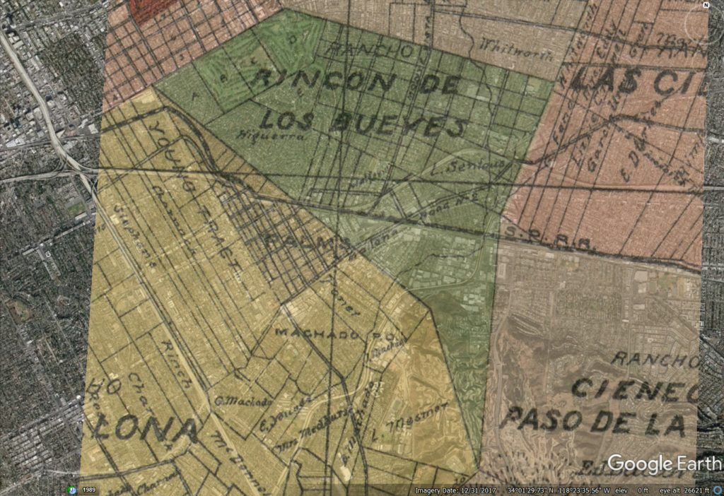
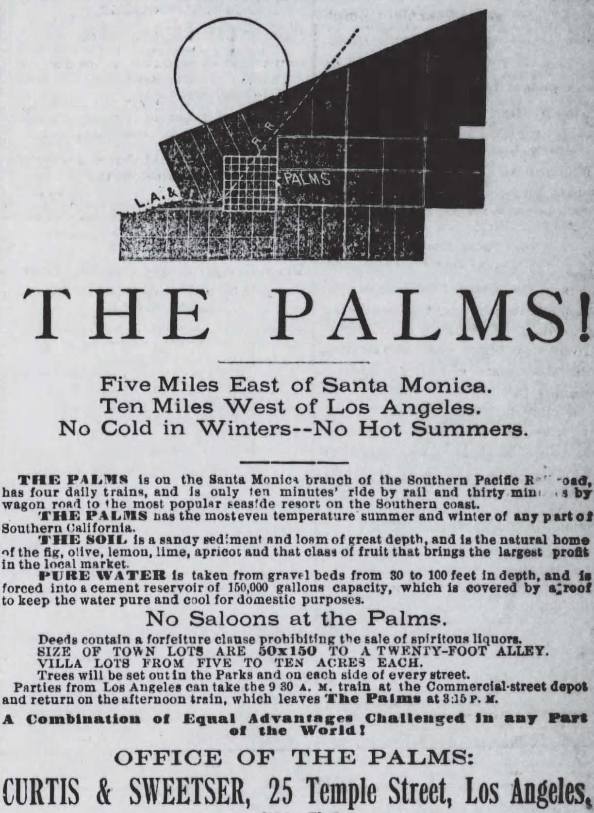
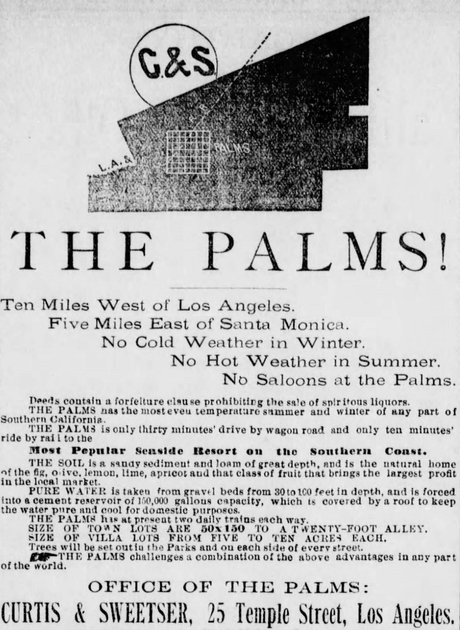
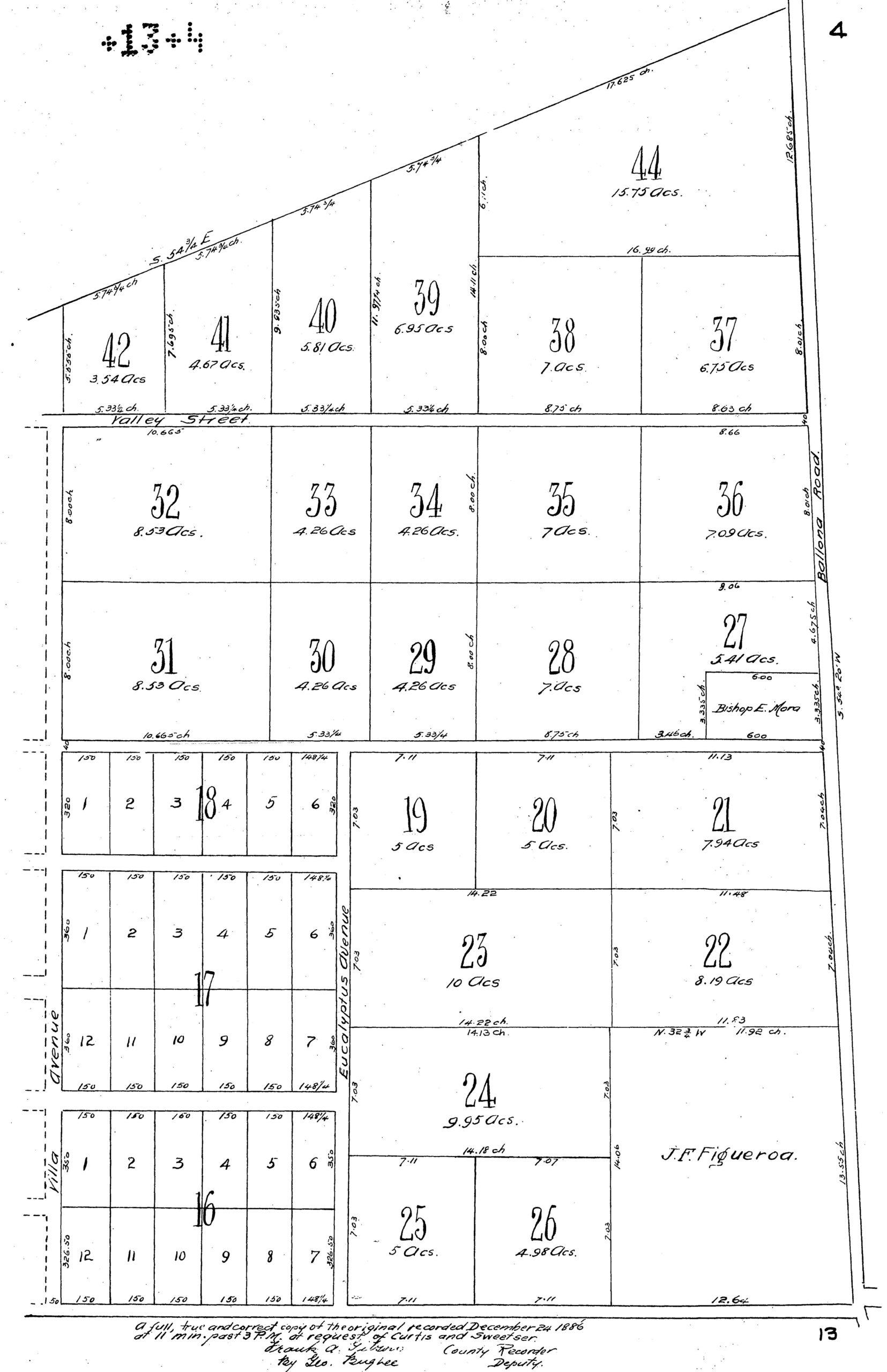
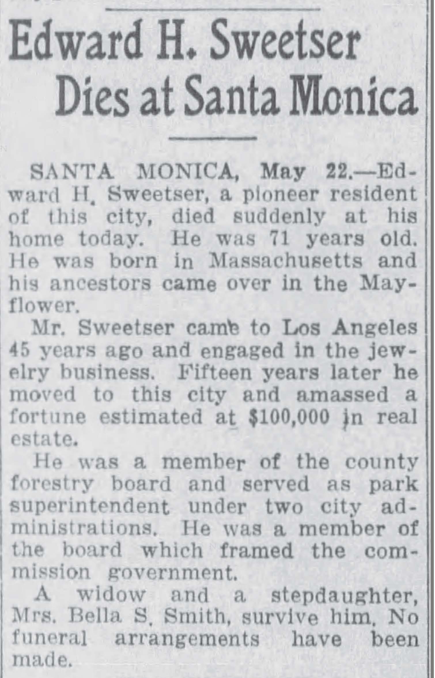
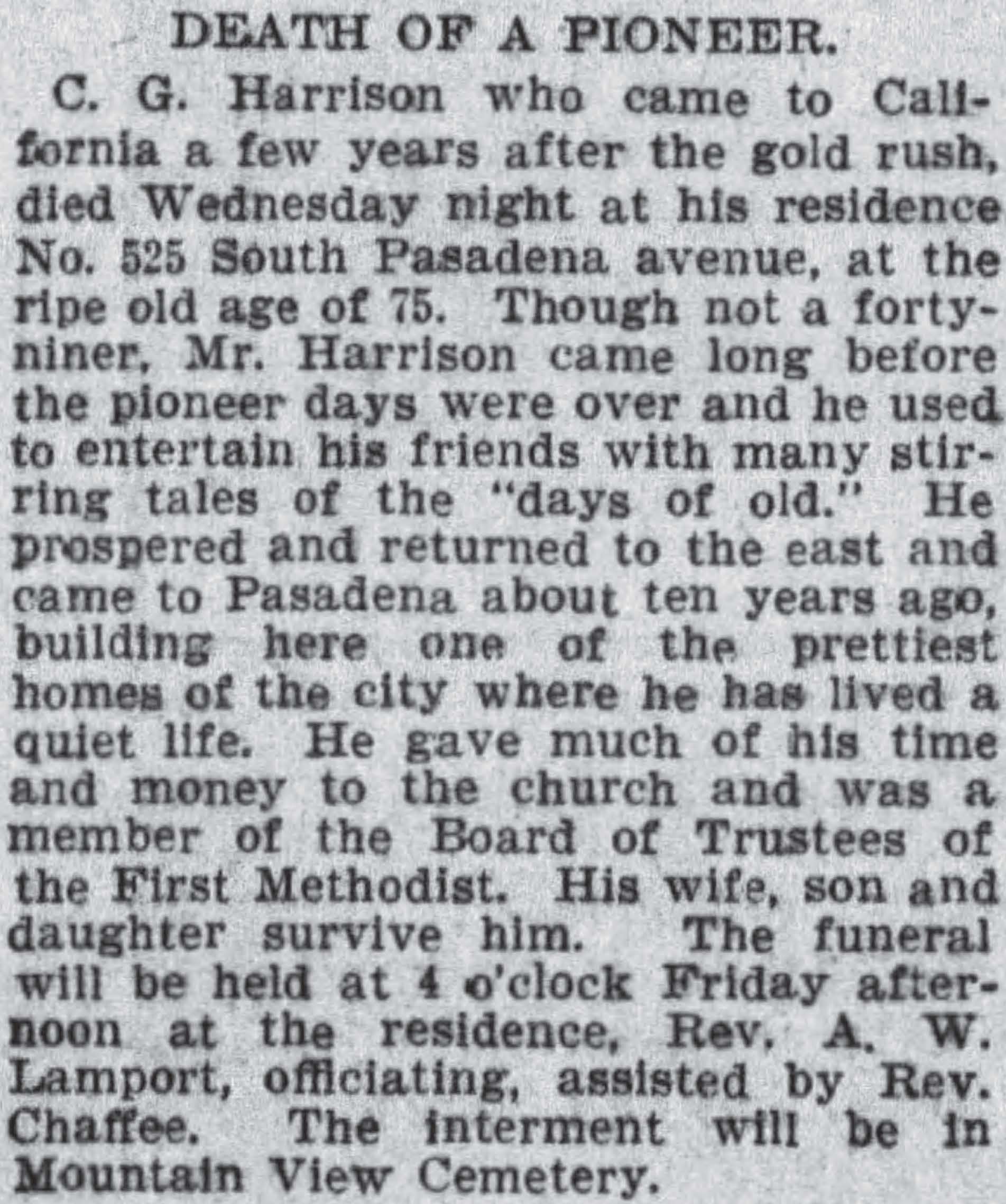
Joseph Curtis (1839-1920), Edward Healey Sweetser (1844-1916) and Cornelius Gooding Harrison (1829-1904) purchased 500 acres of Rancho La Ballona for $80 an acre and subdivided it as “The Palms.” E. T. Wright, County Surveyor, laid out the site in November and the plat was recorded on December 24, 1886.
Palms historian and booster David I. Worsfold called “The Palms” the “pioneer community,” tracing its identity to the La Ballona School (1865) and the Machado Post Office (1874). In those days, Paseo de las Carretas (ox cart road) had become “Ballona Road number 2”; today, it is Washington Boulevard. Another old road, “Santa Monica Road,” crossed through the Ballona Valley to the Rancho San Vicente y Santa Monica and later the town of Santa Monica, which Robert S. Baker (1826-1894) and John P. Jones (1829-1912) founded in 1875 after buying the rancho. Jones and Baker built a different kind of road – the Los Angeles & Independence Railroad – that same year, connecting their settlement to the City of Los Angeles.
The decade that followed the railroad’s opening brought an unprecedented real estate boom to the Ballona Valley. The speculative “Real Estate Boom of 1887” was already notorious history when Joseph Netz wrote:
Passenger rates from Kansas City to Los Angeles had been $70; from Chicago $100; from New York $100. For three months tickets were sold from Missouri River points to Los Angeles as low as $5, and for one day the fare was $1 for a ride of 2800 miles.
1915-1916 Annual Publication of the Historical Society of Southern California.
Finally, as the rates were lowered and the news spread abroad of the fortunes being made in the Los Angeles real estate market, the immigrants stampeded to Los Angeles by tens of thousands, accompanied by a host of boomers who had been through a school of real estate speculation. All legitimate buying and selling of real estate was now forgotten, all standards of measurements and comparison were flung aside.
Further immigration in the early twentieth century brought more home buyers to the Ballona Valley as agriculture and industry moved west from the City of Los Angeles.
At the end of 1886, Curtis, Sweetser, and Harrison laid out their real estate development, “The Palms,” along a bend in the railroad which, by then, had been bought by Southern Pacific. The triangular tract was situated in the northeast corner of the former Rancho La Ballona, along the southwestern edge of the earlier Rancho Rincón de los Bueyes. It was advertised as ten miles west of the City of Los Angeles, which only reached as far west as West Boundary Street (renamed Hoover St. in 1892). The beach, and Santa Monica, were about five miles to the west.