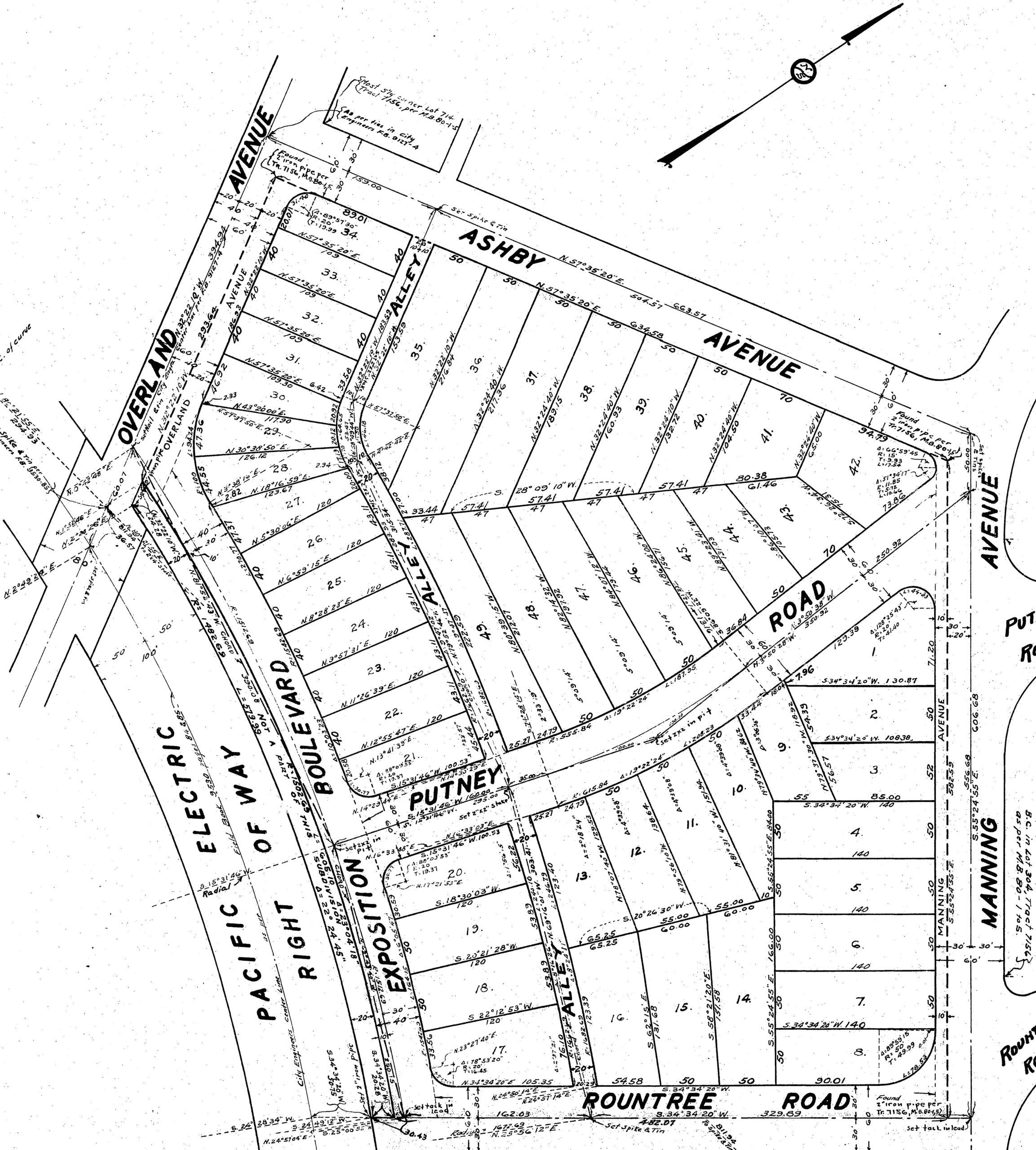
The Tract number 10440 subdivision map was filed on March 29, 1929. It laid out 49 lots for houses, extended Exposition Boulevard (today’s Northvale Road), and added an alley.
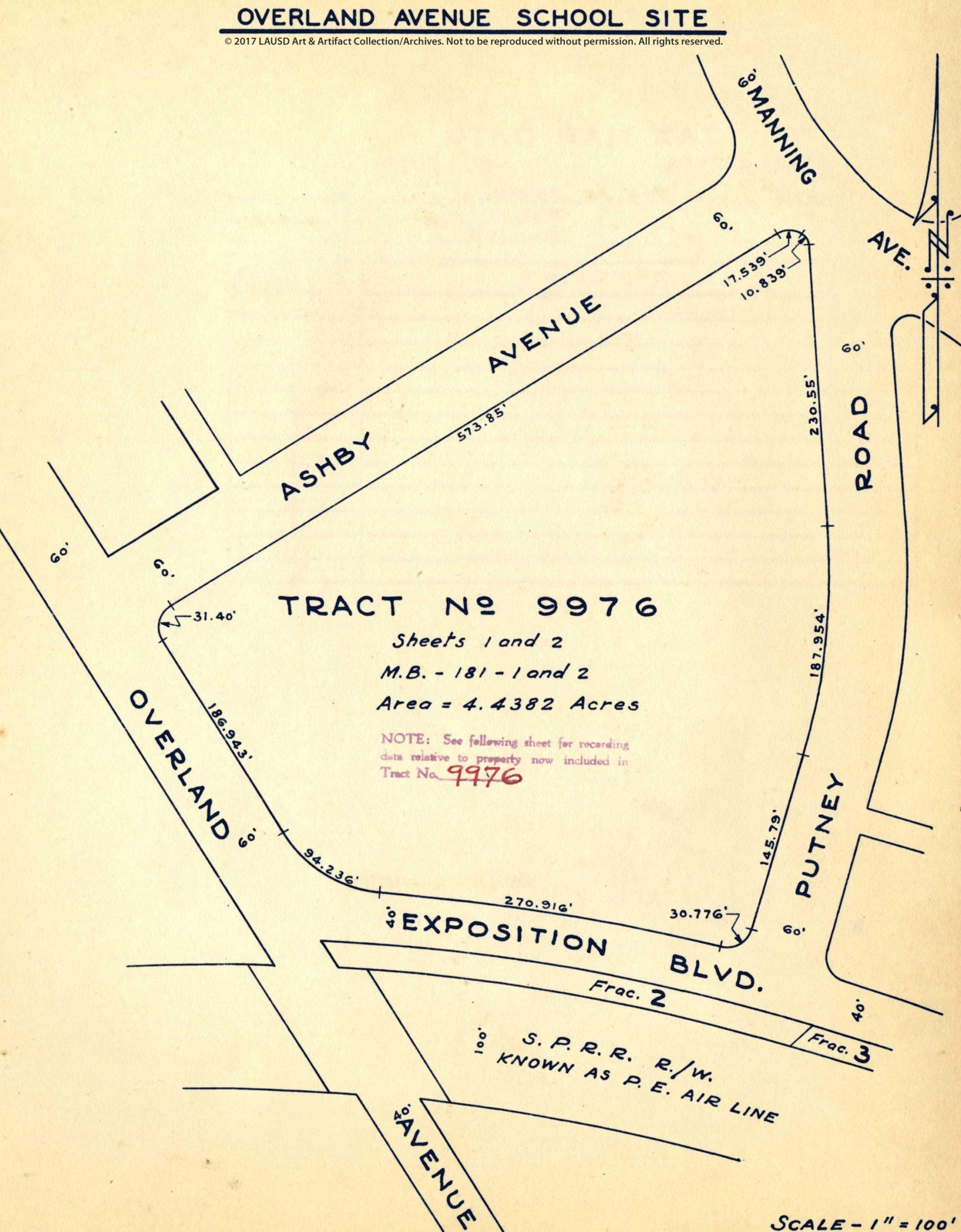
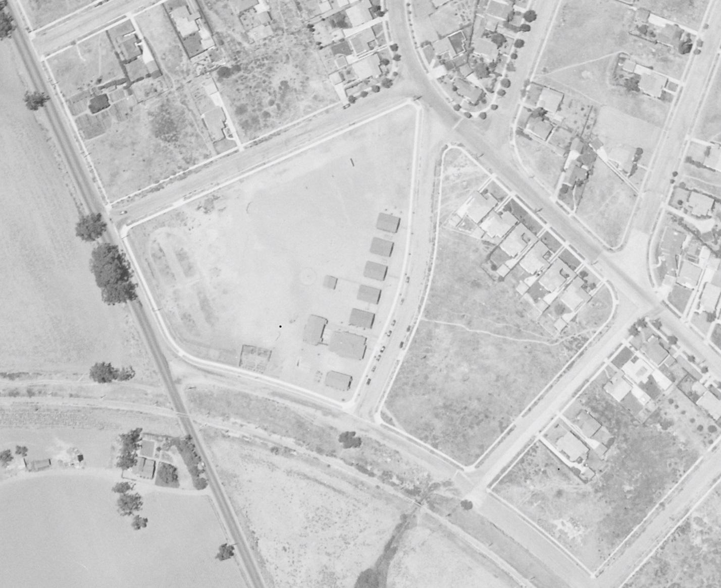
July 18, 1928, Fairchild Aerial Surveys photograph (for Standard Oil Company) of land that would be resubdivided (from the 1886 “The Palms” subdivision of Rancho La Ballona) into Tract 10440. Surrounding the tract are (clockwise from left) Overland Avenue, Ashby Avenue, Manning Avenue, Rountree Road, and the Southern Pacific’s Santa Monica Air Line. Putney Road did not yet cut across the pictured parcel. (Photo courtesy UCSB Library Aerial Photography Collection.)Tract 10440 map filed with Los Angeles County on March 29, 1929.On August 19, 1932, the Los Angeles City School District would resubdivide the district’s portion of Tract 10440 as Tract 9976. The above drawing is from the district.Photograph of Overland Avenue Elementary School’s bungalows before more permanent buildings were erected.June 18, 1934, Fairchild Aerial Surveys photograph (for Los Angeles Bureau of Water Works & Supply – today’s Los Angeles Department of Water & Power) of land that had been subdivided into Tracts 10440 and 9976. Putney Road had been added between them. (Photo courtesy UCSB Library Aerial Photography Collection.)