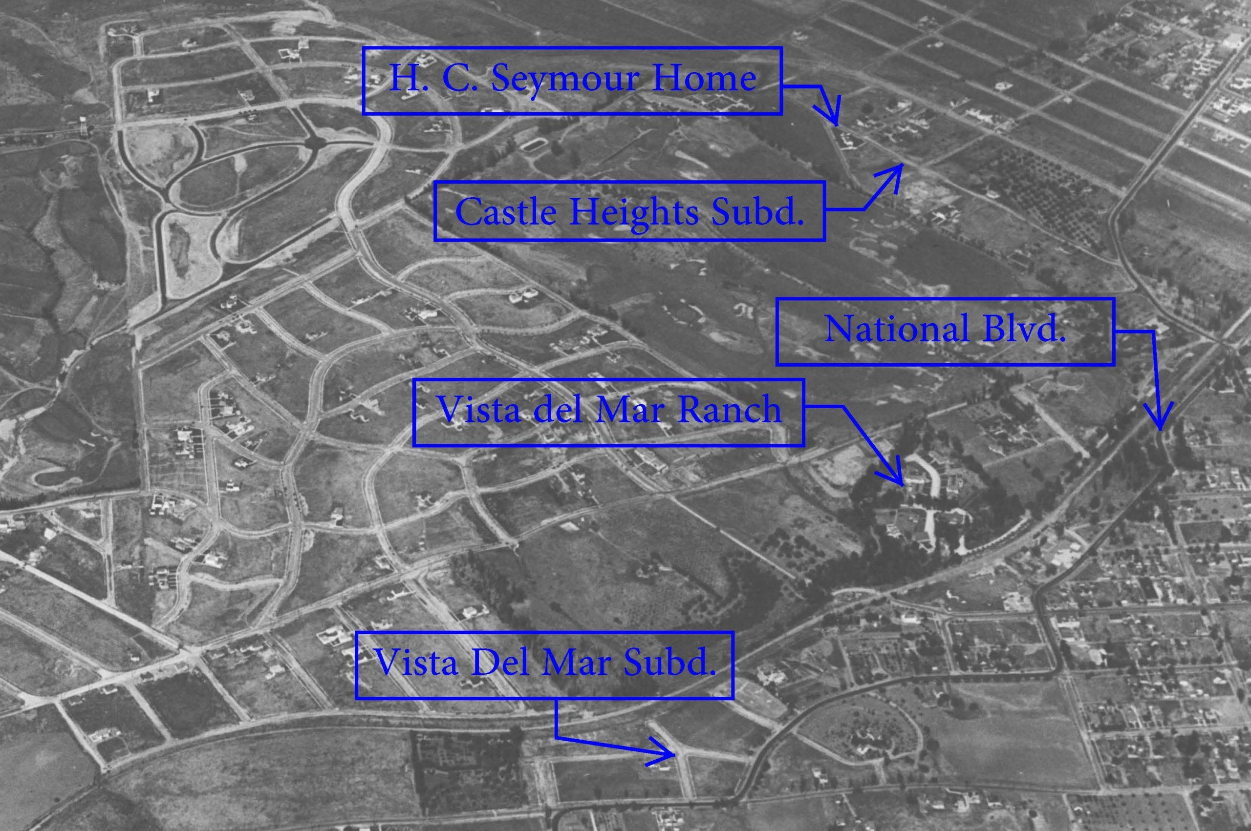
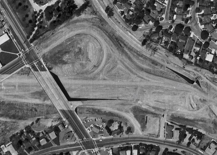
Vista Del Mar popped up in 1923, when Harold Charles “H. C.” Seymour (1885-1931) resubdivided part of The Palms at the northeast corner of Overland Avenue and Mentone Avenue/National Boulevard. (Mentone Avenue would be renamed National Boulevard on March 30, 1925.) Seymour, who had been a salesman for Culver City’s namesake developer Harry Culver, also developed the Castle Heights subdivision. (See the Castle Heights page for more about Mr. Seymour.) The name “Vista Del Mar” may have been inspired by Winship’s Vista del Mar (1898), which was between Mr. Seymour’s Castle Heights home and this new development. In the early 1960s, Seymour’s Vista Del Mar was mostly demolished for construction of the Santa Monica Freeway. (Winship’s Vista del Mar lost much less.) Despite the name – Spanish for “sea view” – it is doubtful one could see the Pacific Ocean from either Vista del Mar.
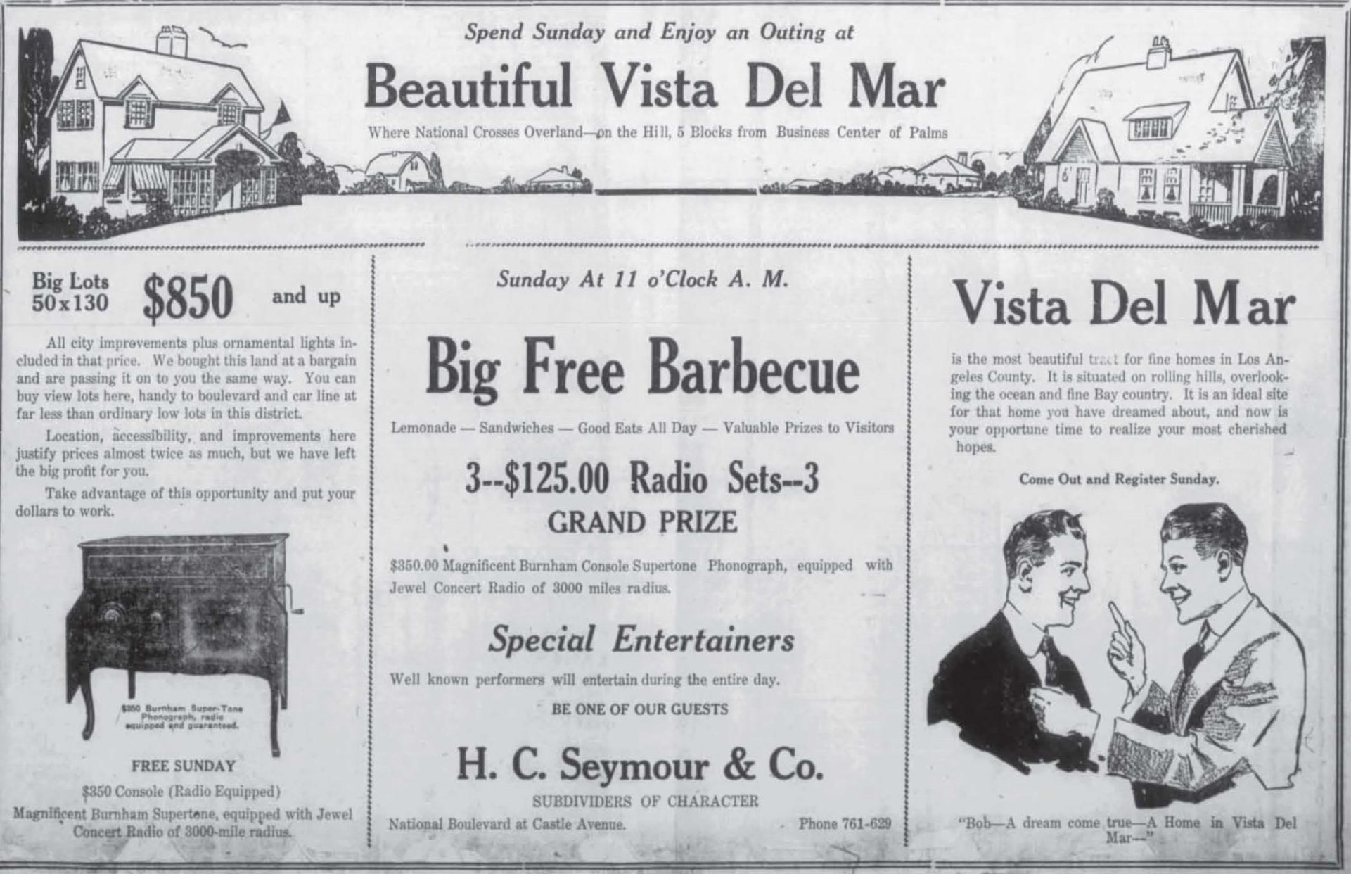
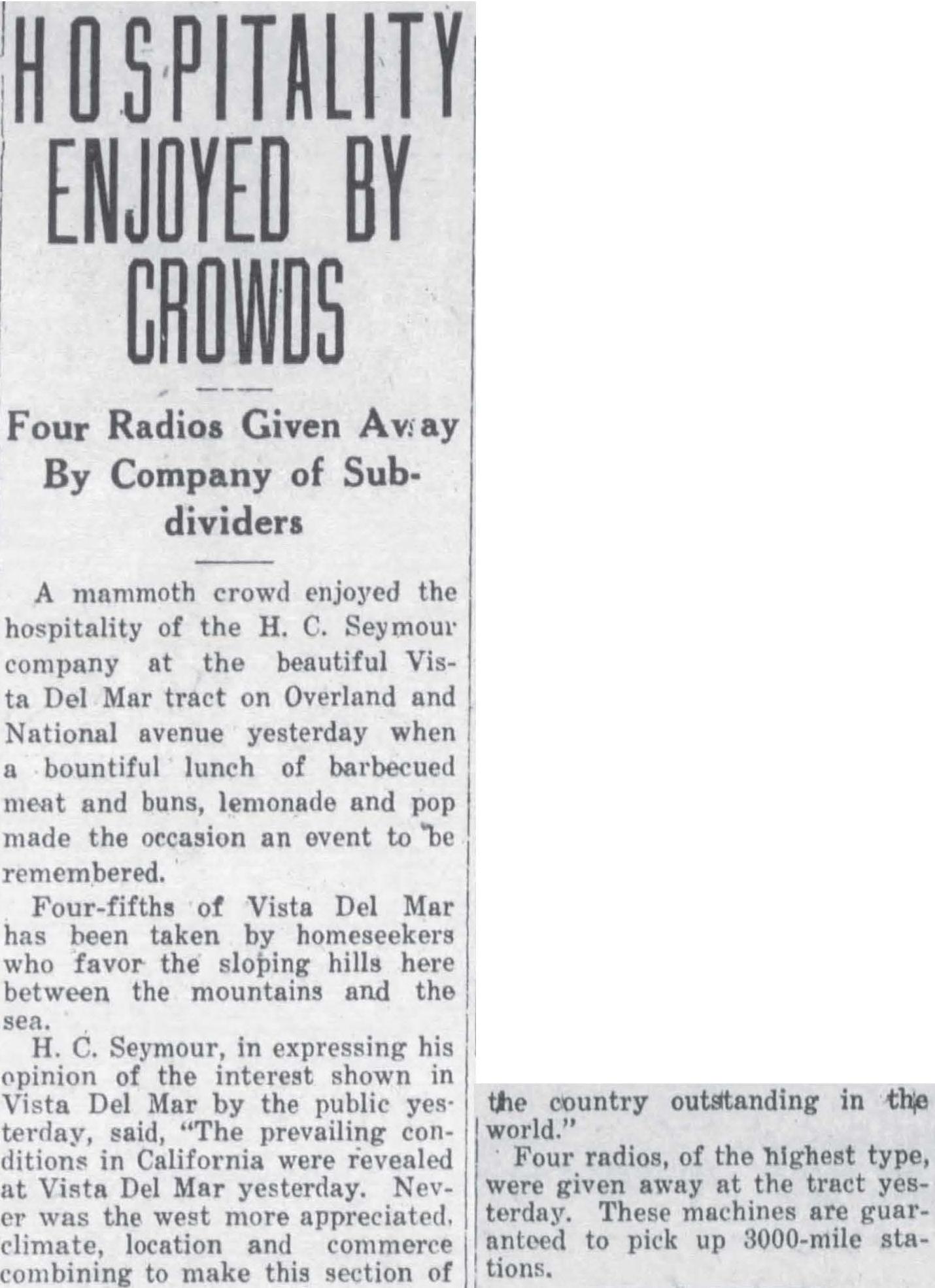
When the “Vista Del Mar” subdivision was recorded at the end of 1923 (two months after the “Big Free Barbecue” in the advertisement above) several residential tracts today collectively called Cheviot Hills were being built out. Castle Heights (1922), Country Club Highlands (1923), Cheviot Hills (1923), and Monte-Mar Vista (1924).
Vista Del Mar Tract Fills In
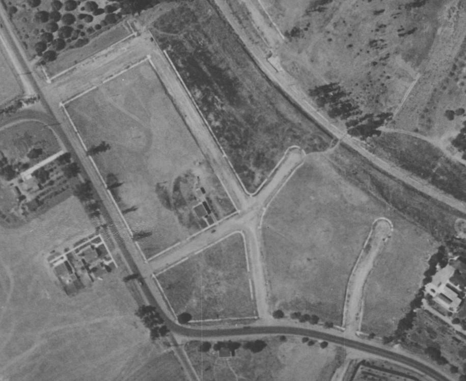
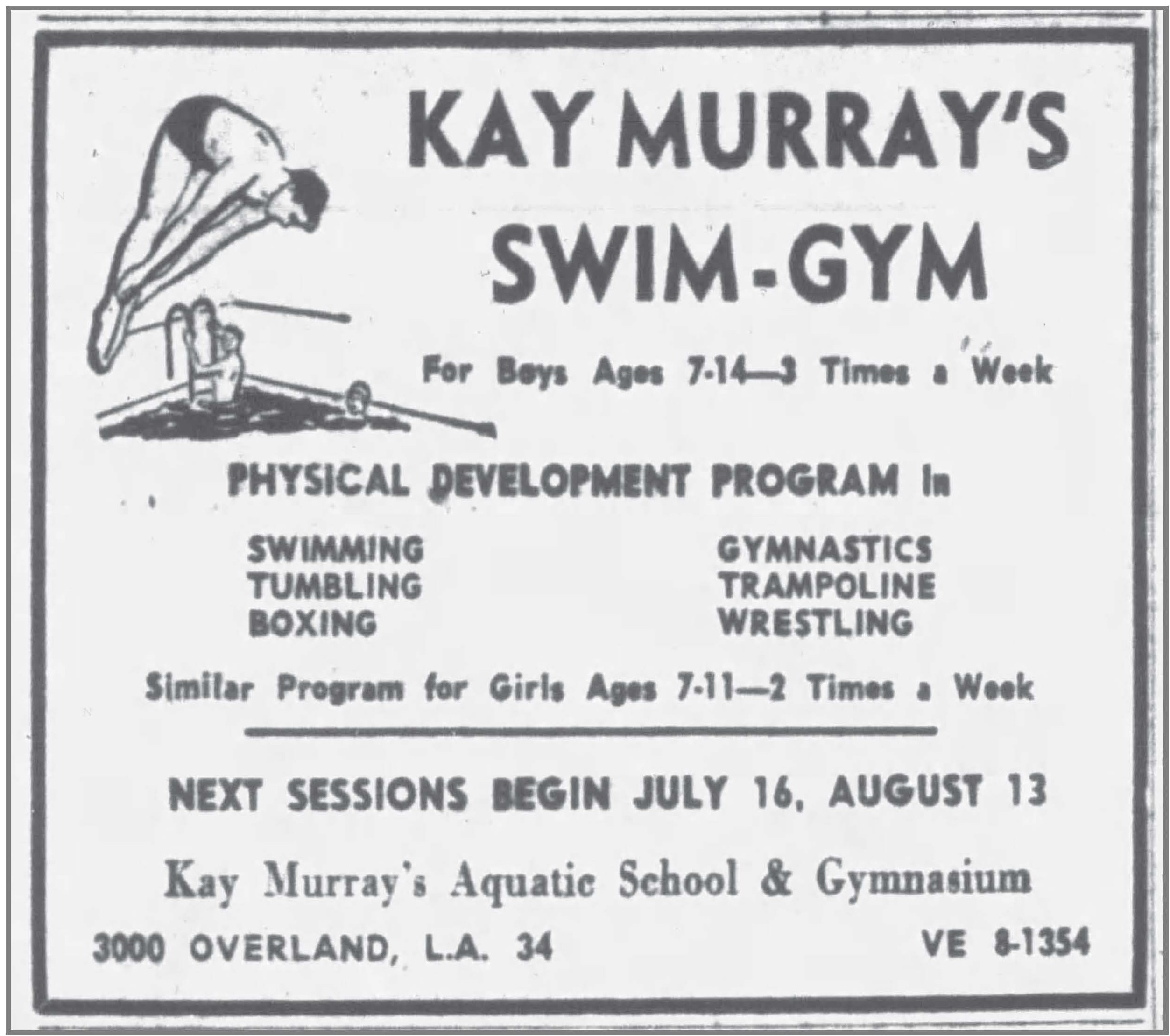
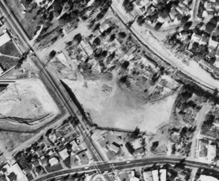
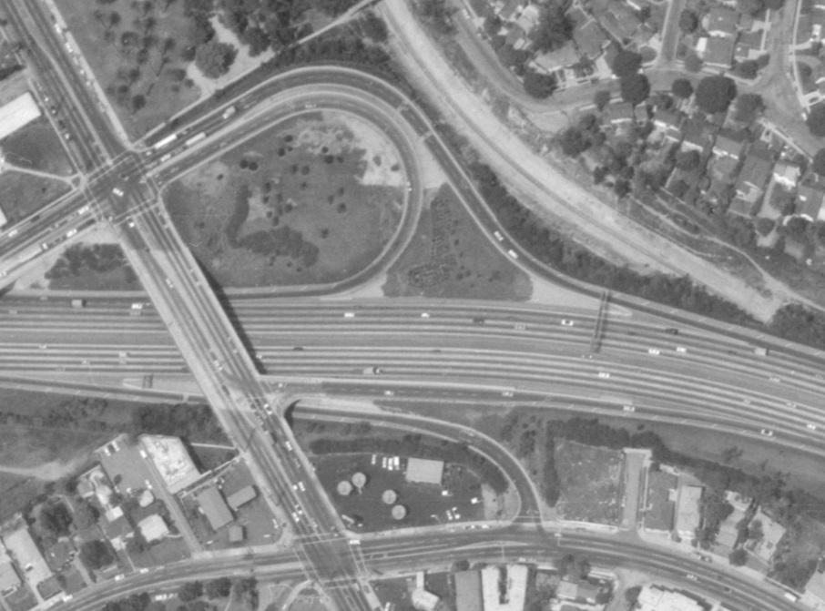
After a slow start in the 1920s, the tract filled up, with most of the building taking place during the late-1930s through the 1940s. The 1956 picture below shows few open lots. Along Overland Avenue, there were mostly businesses – including Kay Murray’s Aquatic School & Gymnasium, Lowe’s Corn Stand, a Mobil gas station, and (south along National Boulevard) Rancho Park Nursery School. A few of those businesses will be described here, starting with Kay Murray’s Aquatic School.
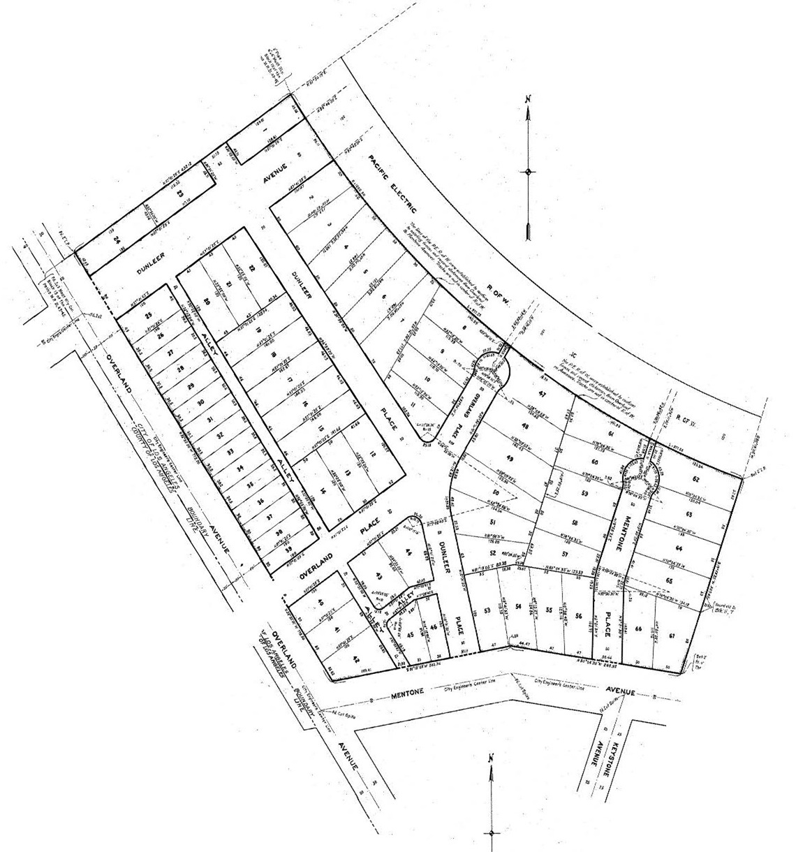
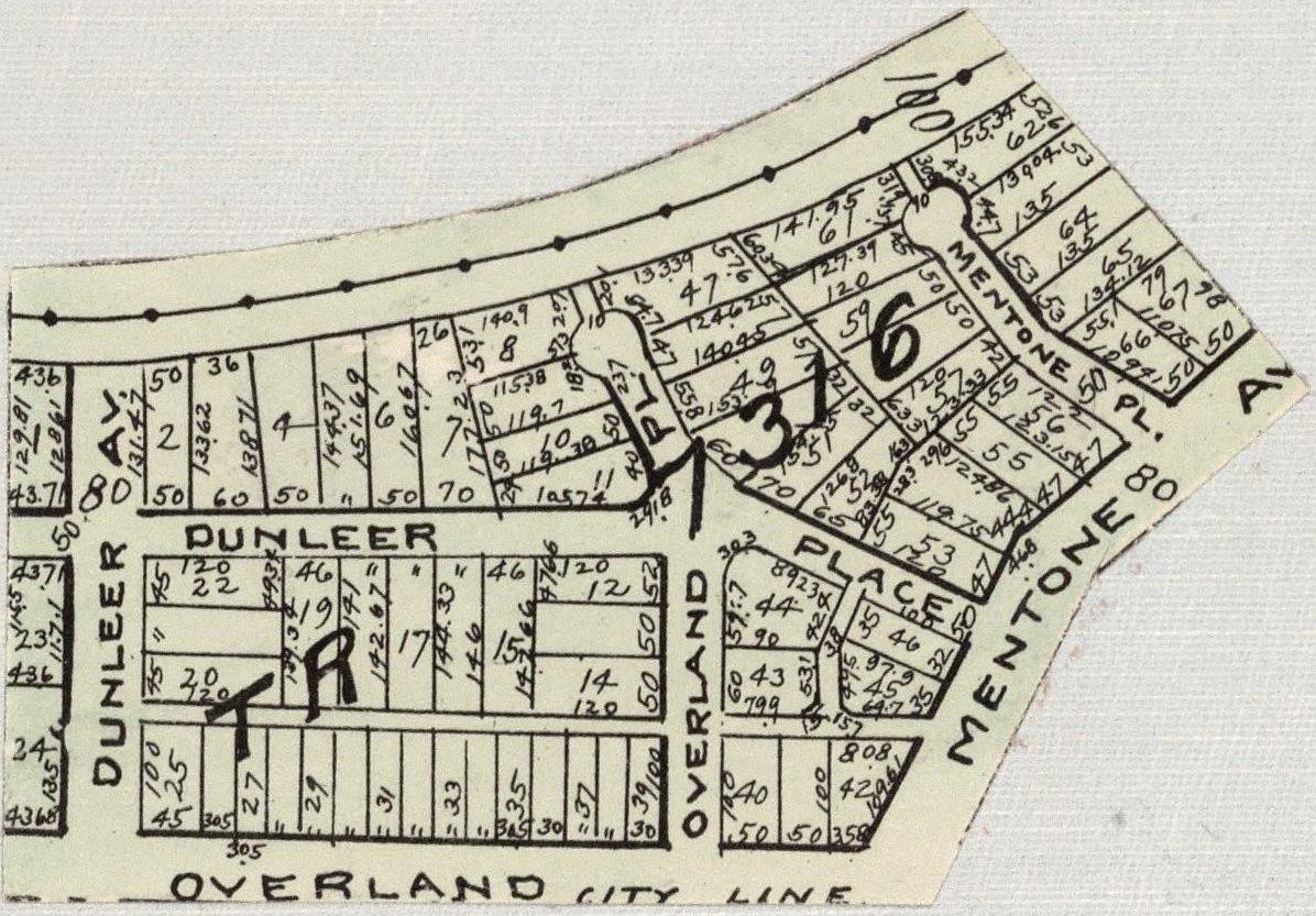
Following his service in the U.S. Navy during World War II, Los Angeles born Kay William Murray (1915-2007), who grew up competitively swimming and was teaching physical education at Emerson Junior High (now Middle) School, pursued his dream of opening a swimming school. In January 1952, he got a building permit for Anthony Bros. Pools (the nation’s largest pool builder) to build a pool for Kay Murray’s Aquatic School at 3000 South Overland Avenue – in Vista Del Mar’s northwest corner (not counting lots 1, 23, and 24 north of Dunleer). It would cover lots 25-27 of the tract.
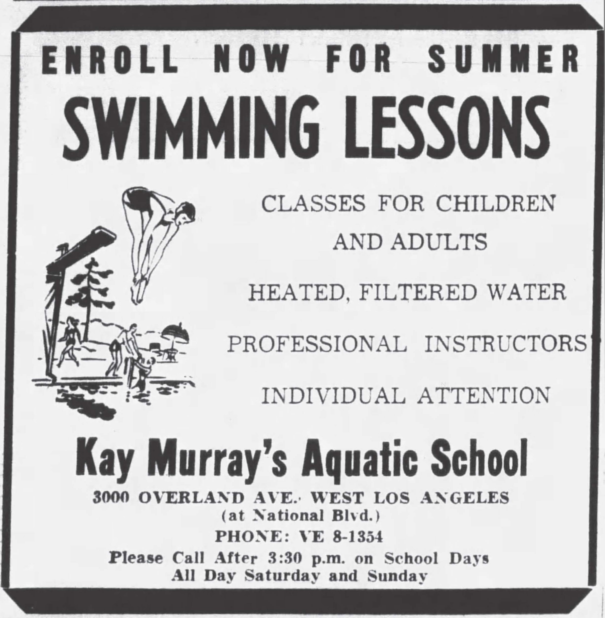
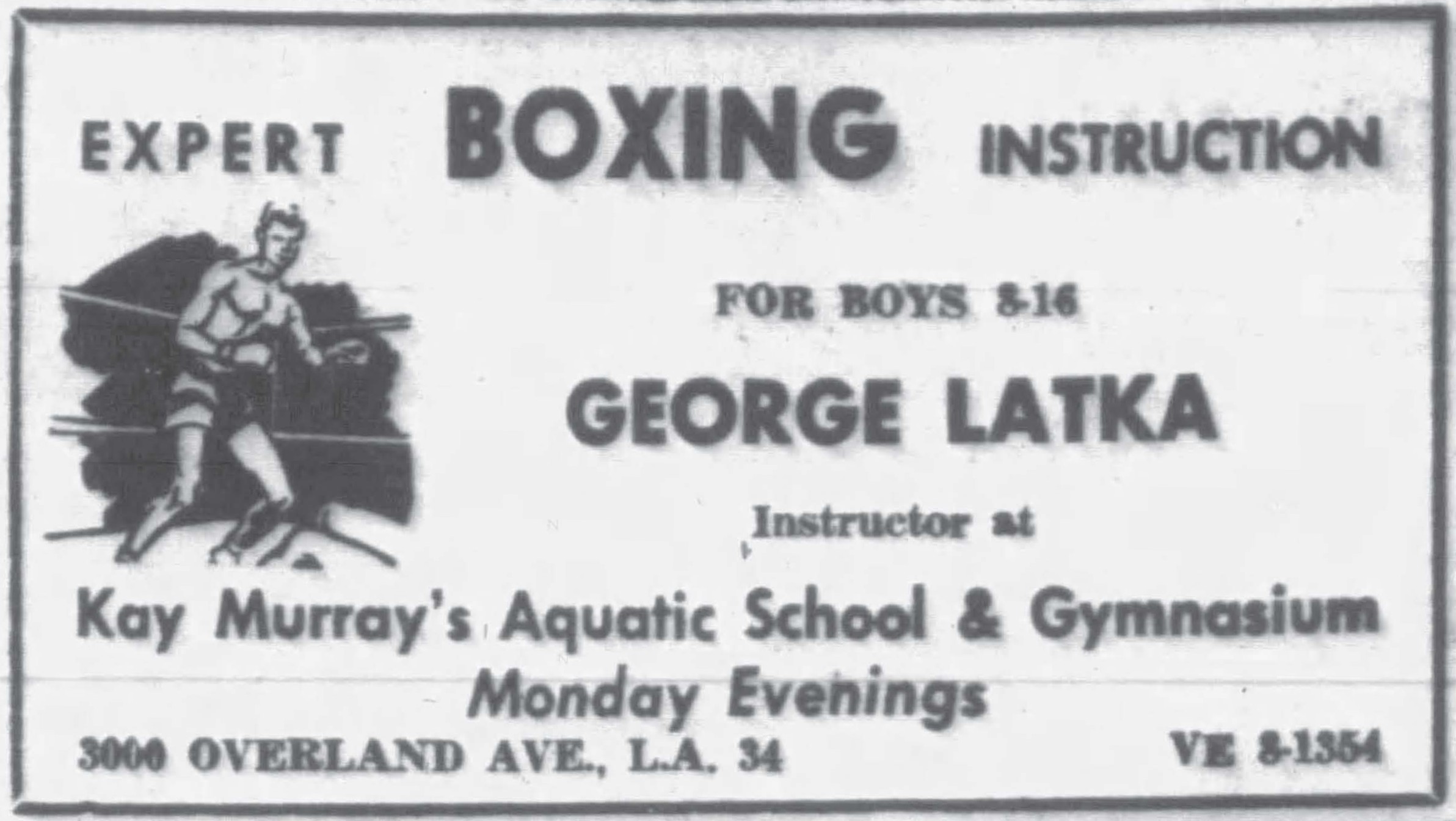
By 1956, Kay Murray’s has added instruction in wrestling, gymnastics, and boxing.
Kay Murray’s boxing classes were under the tutelage of “The Boxing Professor,” George Latka (1914-2007), who is the only person inducted into the World Boxing Hall of Fame as both a referee (1988) and a boxer (1992). According to Mr. Latka’s friend and boxing historian David Martinez, Latka taught actors the basic boxing techniques for “tough guy” movie roles. He also appeared in movies, including playing a referee in Raging Bull (1980).
The facility remained open through at least August 29, 1961. By July 2, 1962, Kay Murray’s had relocated to 11727 Gateway Boulevard, where Murray had built another facility (with another Anthony Bros. pool).
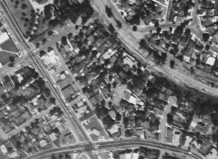
Among the structures south of Kay Murray’s were Lowe’s Corn Stand (discussed below) and various shops, houses, and even a 2-story apartment building. Overland Food Center and Mortson Moving & Storage each occupied 3040 Overland Avenue for part of 1950. At Vista Del Mar’s southwest corner (in the bottom center of the above photo) was a Mobil gas station, built in 1959 at 10611 National (on lots 40, 41 & 42). Immediately to its right, across the alley, was Rancho Park Nursery School (a co-op) which, on May 3, 1948, had opened in a house built in 1945 (on lots 45 & 46) at the corner of Dunleer Place. The school remained at 10605 National Boulevard until at least July 1965. In 1970, Mobil Oil expanded the gas station: it got a demolition permit for 10605 National on July 13, 1970, then resubdivided the area, including the vacated alleys, as tract 22139 on October 29, 1970.
Fighting the Freeway
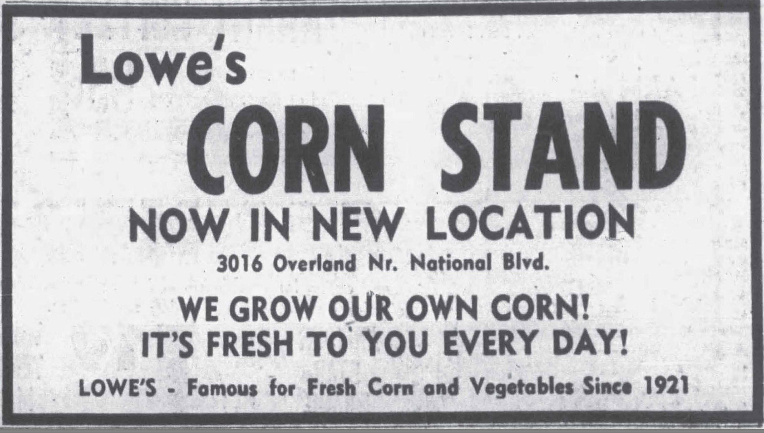
The route of this section of the Santa Monica Freeway (then called the Olympic Freeway) was announced as early as 1955, setting off battles concerning which neighborhood would be bulldozed to make way. The freeway route opposition was headquartered at Lowe’s Corn Stand at 3016 Overland Avenue, which was immediately south of Kay Murray’s. (The store’s site is now inside the western edge of the land “looped” by the westbound freeway onramp at Overland Avenue.)
Westside residents opposed to the Olympic freeway routing have opened information headquarters at 3016 Overland Avenue [Lowe’s Corn Stand].
Staffed by volunteer workers, the headquarters will be open daily from 9:00 a.m. to 5:00 p.m.
Maps of the freeway routes will be made available for study, protest petitions and form letters to protest the freeway also will be available.
Staff at the headquarters will answer questions and bring residents up to date on the community problem.
(L. A. Evening Citizen News, Nov. 4, 1955).
When the freeway threatened, Lowe’s Corn Stand was owned and operated by Walter Henry Lowe (1890-1957). In 1954, he had moved it from 10537 National Boulevard to 3016 Overland Avenue “because of Los Angeles zoning laws.” (The news report said the corn was “picked every morning from the Lowe fields at Malibu and sold the same day.“) Walter descended from Palms’ “pioneer” families. His grandfather, Henry Lowe (1836-1913), was one of several Iowans to emigrate together to the Ballona Valley in 1882 to farm the area. Walter’s father, Simeon Jethro Lowe (1862-1949), opened the store in 1921 as an outlet for the family’s nearby farm. A 1940 news report, announcing a “branch stand” at 1949 La Cienega Boulevard, said “they will sell the same high quality corn, raised in Palms fields.” The hill on Overland Avenue north of Rose Avenue was once called “Lowe’s Hill.” (It was lowered by 30 feet in the early-1970s.)
California Assembly-member Thomas “Tom” Mankell Rees (1925-2003) fought on their behalf to reroute the freeway:
A 30-year-old freshman legislator, bucking urgent appeals for early construction of the Olympic Freeway, yesterday carried the fight against routing of the disputed superhighway through West Los Angeles to the State Highway Commission.
Thomas M. Rees of the 59th Assembly District charged at a public hearing in the State Building that 80% of the route recommended by the State Division of Highways would cut through residential areas of Rancho Park and West Los Angeles, none more than 10 years old.
Rees . . . contended that the proposed Olympic Freeway route would split the Rancho Park community.
“It would constitute a wall diagonally across this area,” he declared. “As it is set up now, it comes within a few hundred yards of three schools and just as close to a new grammar school and a new high school.”
Freeway Will Ruin Homes, Board Told – Residential Areas on 80% of Route, Legislator Claims (L. A. Times, Sept. 20, 1955).
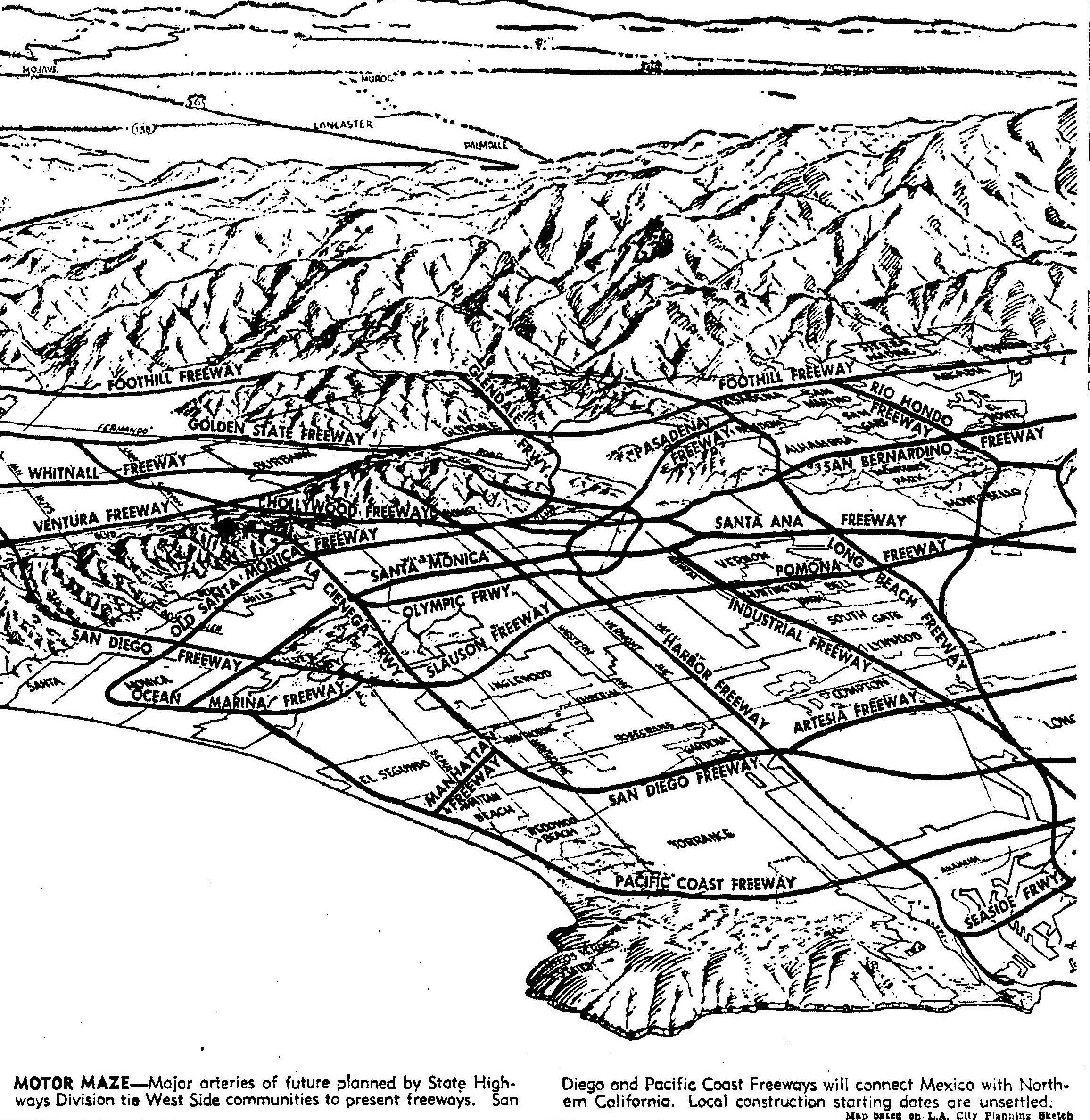
Ultimately, the freeway curved away from homes in the newer and more affluent Cheviot Hills tracts – Cheviot Knolls (1938) and California County Club Estates (1951) – and gutted the older, less affluent Vista Del Mar (1923) subdivision.
Buildings Moved out of Vista Del Mar
Throughout 1961 and into 1962, houses, a store, and even an apartment building were moved. Houses from Vista Del Mar went as far away as Pacoima, Arleta, Sun Valley, Tarzana, Wilmington, and San Pedro. Some houses stayed on the Westside, going to Mar Vista, Rustic Canyon, and Marina del Rey.
One house started its life in 1919 at 5627 Fernwood Avenue in Hollywood before being moved in 1948 to 10603 Overland Place in Vista Del Mar – apparently to make way for the Hollywood Freeway. In 1961 it moved back east, this time to Mid-City, just a block north of the under-construction Santa Monica freeway. Moving houses out of the way of one freeway and into the way of another was a concern raised by Los Angeles City Councilman Ernani Bernardi (1911-2006), who said he had “received reports of some homes being relocated in paths of future freeways.” He wasn’t looking as far back as the Hollywood Freeway, since his San Fernando Valley district was where a number of houses were landing – and where several highways were in the planning stages. The response from the California Division of Highways, “the largest single public right-of-way and land acquisition agency in the country” as of 1961, was essentially that, until the freeway route was officially approved, it would move houses where it wanted: “the state attitude is that funds are available to purchase rights-of-way and property only after freeway routes are officially adopted and that tentative adoption does not mean the route will be the same upon final adoption.”
A 2-story, 2-family apartment built in 1953 at 3054-56 Overland Avenue building was moved to 3157-59 Oakcrest Drive in the Hollywood Hills. Next door, at 3060-62 Overland Avenue (also addressed 10669 Overland Place), a 1-story, 6 room Stucco house was one of dozens of buildings listed for auction (on April 20, 1961) by the California State Division of Highways. As of 2025, the house remained in Woodland Hills.
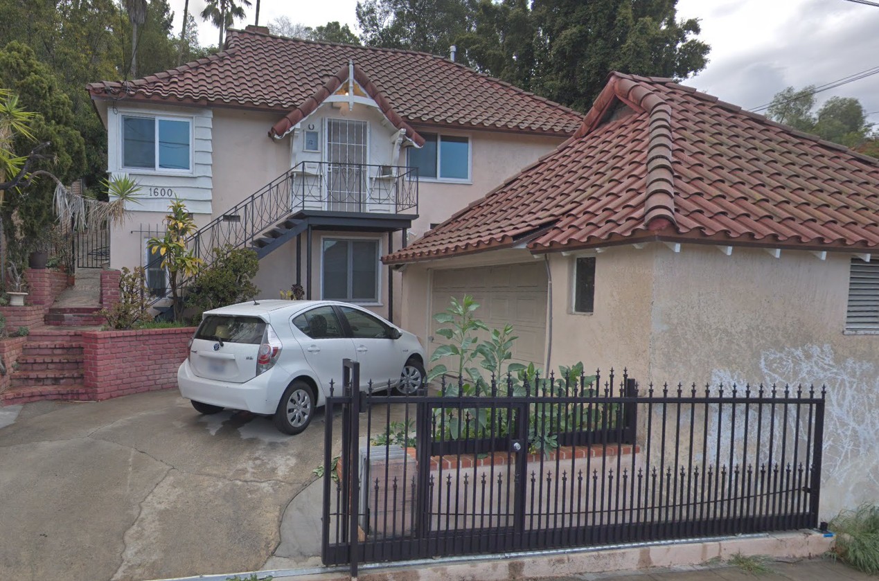
Several of Vista Del Mar’s houses were built by Edmond John Aiken (1889–1988), who was known for his English style cottages. Aiken himself lived in one at 3165 Mentone Place. In 1961, the house he built at 3175 Mentone Place was moved to 1600 Lemoyne Street in the Echo Park neighborhood. (Read more about Mr. Aiken and his houses here.)
The Howard & Harte furnace store building, erected in 1949 at 3050 Overland Avenue (lot 36), was moved to Chatsworth in 1961. (Howard & Harte had relocated from 1948 Westwood Boulevard in August 1949; it apparently lasted on Overland only until 1951.)


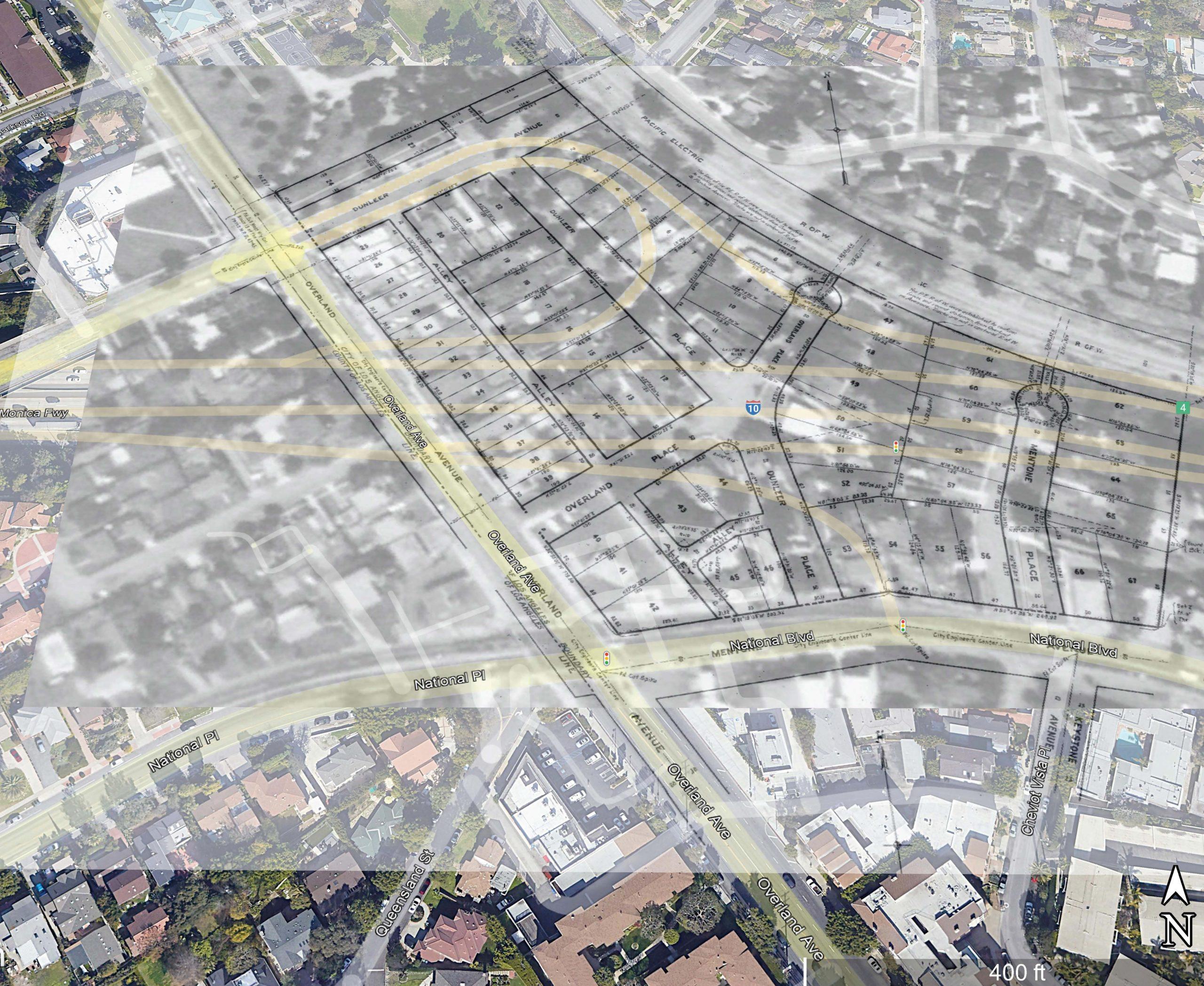
Three multi-family dwellings cover the only remaining residential lots in the Vista Del Mar subdivision. In the tract’s southeast corner, lots 55 and 56 hold 3189 Cheviot Vista Place (permitted in 1963, when the freeway was being built). Lot 66 holds a single building, erected in 1953, with several addresses: 10577 National Boulevard and 3184, 3186, 3188, and 3190 Cheviot Vista Place. And 10571 National Boulevard (built in 1950) is on lot 67. One (shortened and renamed in 1965) street remains from the tract: Cheviot Vista Place, which was originally laid out as Mentone Place. The “Vista” in the street name is more likely an effort to leverage Cheviot Hills’ prestige than a nod to the tract’s Vista Del Mar moniker, since the tract name was probably forgotten before the freeway led to its demise. In those 40 years between its development and its demolition, the subdivision name never appeared in the newspapers.